Create a Quick Map using Excel data and Fusion Table of Google
- Geoinformers
- Feb 3, 2018
- 1 min read
A new very useful Google fusion table has been introduced. Using it we can generate map of our area of interest with in few minutes. We need ground truth points with Lat Long values in excel workbook and we can plot those points on Google Map or Google Map satellite similar to ArcGIS online. To create a map, we need our Google account and Google drive interface in which fusion table will be loaded. We can choose which parameters from the excel data will be shown on map. A detailed You Tube video is attached herewith, that will show steps involved in this process-
Fig: Choose which column to be displayed-

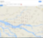
Fig: Map Created using Excel data and Fusion Table-

Fig: Map with satellite images created using Excel data and Fusion Table-


